TRL Transformational Maps
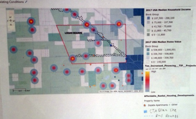
In our Humanities unit Thin Red Lines, we learned about making maps, cartography, and the meaning that maps have behind them. For our Action Project, we were asked to make maps of our own, making sure that they were transformational maps. We also had to write rationales for all of our maps, explaining the cartographic choices we made. Below are pictures of the transformational maps that I made, as well as the rationales that I made to go with them. The issue that this map addresses is gentrification in Logan Square.The boundaries of my map are: Diversey Ave, Bloomingdale Ave, Western Ave, and Pulaski Rd. Gentrification occurs when a neighborhood gets redeveloped and its housing prices go up, forcing lower-income residents out and moving more higher-income residents in. I chose to use warmer colors for the TIF project areas to make them pop out. I included several different categories onto my map. Those categories were: Mobility, demographic and housing profile, community history ...